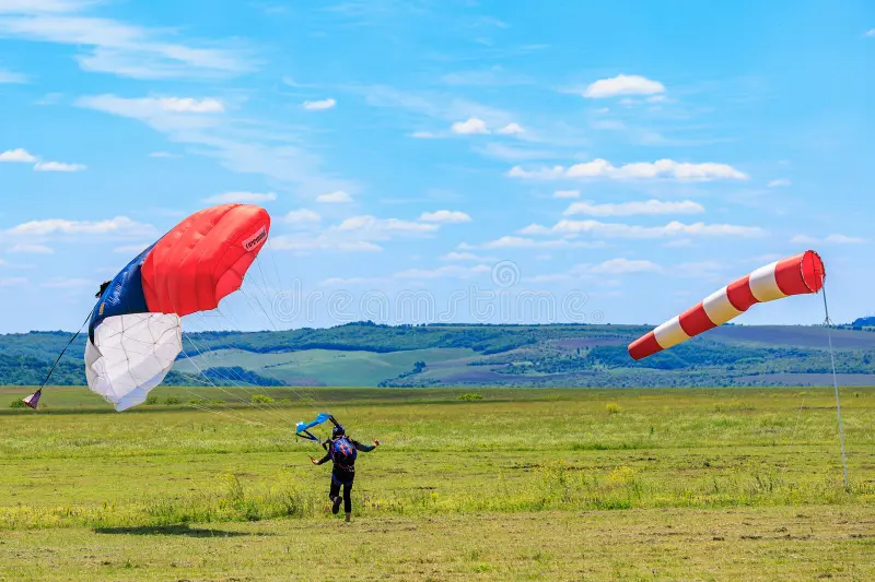
How to Manage Wind Risk: Boundary Layer Safety and Flow Analysis
The atmospheric boundary layer functions as an unpredictable, high-velocity kinetic system that heavily impacts low-altitude flight safety. Evaluating how air currents interact with geographic landforms requires an analytical approach rooted in fluid dynamics and micrometeorology. For any flight facility or dropzone, surface winds are never uniform; they constantly shift across localized topographic obstacles, runway surfaces, and thermal boundaries. Understanding these invisible atmospheric movements is essential for protecting unpowered canopy pilots and light aircraft during their final landing approaches.
When high-velocity winds encounter physical obstacles like airport hangars or natural ridges, the steady air mass breaks apart into turbulent, rotating pockets of air called mechanical rotors. These downward-spinning vortexes can cause sudden losses of airspeed and aerodynamic lift right as an aircraft or parachute flares for touchdown. Because of this, safety managers must constantly evaluate real-time wind shear data rather than relying entirely on broad regional forecasts. This systematic observation allows operators to detect dangerous low-altitude currents before they impact flight patterns.
Understanding “how to manage wind risk”
Mitigating atmospheric hazards at a busy landing facility requires a deep understanding of fluid dynamics and real-time risk assessment. Airflow safety cannot be achieved by relying on simple ground-level velocity readings. Instead, operations must track how wind currents behave across different vertical layers and terrain features.
Deconstructing the Velocity Gradient
A frequent mistake made by field operators is assuming that a uniform breeze at the runway surface means conditions are safe higher up. In reality, friction against trees, buildings, and ground vegetation creates a pronounced wind gradient.
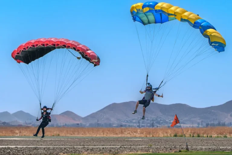
As an unpowered canopy descends through this vertical gradient, it experiences rapidly shifting airspeeds that can destabilize landing approaches. Implementing comprehensive strategies for how to manage wind risk is critical for protecting less experienced pilots from these hidden boundary layers.
Topographic Obstruction Complications
Oversimplified weather assessments often ignore the physical structures surrounding an airfield. When stable air currents hit wide hangar walls or tree lines, they generate downwind turbulent zones that stretch horizontally for up to ten times the height of the obstacle.
Failing to map these turbulent zones exposes descending pilots to sudden crosswinds during their final landing flare. Developing a proactive safety protocol requires analyzing how these invisible air wake patterns shift whenever the prevailing wind direction changes.
Deep Contextual Background and Systemic Evolution
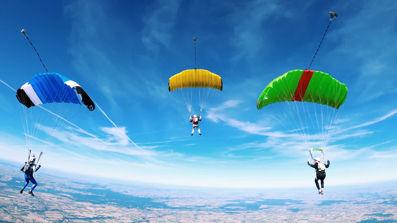
The structural governance of wind mitigation protocols in civilian aviation evolved significantly following the widespread adoption of high-performance ram-air parachutes. Early round-canopy platforms possessed minimal forward speed, making them highly vulnerable to drifting off-course during high-wind events.
The Aerodynamic Performance Shift
The transition to square, pressurized ram-air wings during the late twentieth century allowed pilots to penetrate stronger headwind currents. However, these faster wings also increased vulnerability to low-altitude mechanical turbulence and sudden wind shear.
Modern Operational Realities
In today’s operational environment, modern flight facilities utilize automated weather networks to track real-time gust spreads across different sectors of a runway.
These integrated monitoring networks have largely replaced old visual estimation methods, protecting operations from the sudden low-altitude wind shifts that historically compromised landing patterns.
Conceptual Frameworks and Mental Models
Navigating the invisible hazards of atmospheric turbulence requires specific mental models that connect wind energy with physical terrain structures.
The Downwind Wake Rotor Model
The primary model used by air safety officers is the Downwind Wake Rotor Model. This framework explains how steady airflow transforms into a chaotic spinning vortex after crossing a sharp physical obstruction.
Managing Rotor Vortex Risks
This model shows that the air directly behind a large building behaves like a breaking ocean wave, tumbling downward and creating sudden sink pockets. Pilots must plan their landing paths to avoid this turbulent zone entirely when wind speeds pick up. The limitations of this model are reached during extreme thermal heating, which breaks apart standard mechanical rotors and creates unpredictable, swirling micro-bursts across the field.
The Thermal Convective Displacement Matrix
A secondary framework is the Thermal Convective Displacement Matrix. This model maps how varying ground surfaces absorb solar radiation differently, generating localized updrafts.
Minimizing Convective Updraft Hazards
This matrix helps safety crews anticipate localized wind shear when cool air from grassy fields flows onto hot asphalt runways. Passing through this thermal boundary can cause an aircraft or canopy to lift unexpectedly, disrupting final approach calculations. Understanding these thermal patterns allows safety officers to adjust landing configurations before ground-level winds become unstable.
The Kinetic Gradient Compensation Loop
A third framework is the Kinetic Gradient Compensation Loop, which models how rapid wind speed drops near the ground affect canopy lift.
Adjusting Approach Glides
This loop shows that when a canopy enters a slow surface wind layer, it loses lift rapidly before its ground speed can adjust. Pilots must maintain extra airspeed during their final turn to counter this sudden loss of performance near the ground. This model helps instructors teach students how to execute deeper, more controlled landing flares during high-wind days.
Key Categories and Technical Variations
Atmospheric risks vary significantly based on geographic location and regional weather patterns. Each landing environment presents unique challenges that require specific management strategies.
High-Velocity Laminar Flows
Steady, predictable sea breezes typical of coastal dropzones. These winds offer excellent horizontal stability but can mask significant wind gradients near dune lines and hangar structures.
Convective Desert Thermals
Swirling, heat-driven air columns common in arid basin environments. They create severe low-altitude lifting forces that require wide landing patterns and frequent operational stand-downs during peak afternoon heat.
Orographic Mountain Waves
Powerful downwind currents generated when heavy air masses pour over large mountain ridges. These waves create severe turbulence zones that can extend several miles away from the base of the ridge.
Gust Front Micro-Bursts
Rapidly moving walls of cool air pushed out ahead of approaching rain showers. These events cause violent, sudden wind shifts that require halting all flight activities immediately before the storm front arrives.
Choosing Operational Limits
Matching a pilot’s experience level against the geographic complexity of the field is crucial for maintaining safety margins. Student pilots are typically grounded when gust spreads exceed five knots, even if total wind velocity remains below their structural limit.
Advanced high-performance pilots can operate in more complex wind environments, but must use precise, aggressive canopy inputs to counter localized air shear.
Detailed Real-World Scenarios
Scenario A: Navigating Hidden Wake Rotors at Urban-Fringe Airfields
A high-performance canopy pilot enters their final crosswind landing leg downwind of a new three-story hangar complex.
-
Constraint: Surface winds are blowing at 18 knots directly across the wide roof line of the hangar building.
-
Decision Point: The pilot must decide whether to follow their standard landing path or crab into the wind toward an alternate grassy clearing upwind.
-
Failure Mode: Sticking to the standard path and entering the low-altitude air wake directly behind the hangar structure.
-
Second-Order Effect: The canopy encounters severe mechanical shear at an altitude of 40 feet, collapsing the left wing tip and causing a hard touchdown.
Scenario B: Managing Rapid Thermal Shifts in Desert Basin Dropzones
An instructor is guiding a student canopy pattern via radio during a hot summer afternoon in an arid desert basin.
-
Constraint: Intense ground heating generates a spinning dust devil that moves quickly toward the student landing target area.
-
Decision Point: The instructor must instantly decide whether to hold the student into the wind or command an immediate turns-away maneuver.
-
Failure Mode: Freezing up or giving late radio commands, allowing the student to fly straight into the thermal column.
-
Second-Order Effect: The canopy loses internal pressure and enters a rapid spiral turn, resulting in a hard landing that strains the student’s legs.
Scenario C: Handling Unexpected Orographic Waves in Mountain Valley Sectors
A single-engine jump plane climbs through 8,000 feet near a steep mountain ridge line during a high-wind winter event.
-
Constraint: A powerful orographic downwind wave creates a severe 1,500-foot-per-minute sinking air pattern across the climb corridor.
-
Decision Point: The pilot must choose whether to continue forcing the climb or turn back toward the center of the valley to find lifting air.
-
Failure Mode: Maintaining a steep pitch angle while stuck in sinking air, which overheats the engine and reduces airspeed close to stall limits.
-
Second-Order Effect: The pilot is forced to abort the jump run early and execute a low-altitude turn back to the runway, disrupting safety margins.
Scenario D: Managing Sudden Marine Fog Shifts at Coastal Operations
A group of sport jumpers exits a twin-engine turboprop aircraft at 14,000 feet over a coastal marine landing zone.
-
Constraint: A rapid sea breeze shift drives a low bank of marine fog across the airfield, completely obscuring the primary landing target.
-
Decision Point: The group must quickly decide whether to hunt for the runway through the fog or steer toward an open beach landing zone downwind.
-
Failure Mode: Descending straight into the thick fog layer without clear visual ground references or an instrument rating.
-
Second-Order Effect: Multiple jumpers overshoot the airfield boundaries and land on nearby public highways, resulting in serious equipment damage.
Planning, Cost, and Resource Dynamics
Proactively managing weather risks requires significant investments in advanced monitoring systems and ongoing staff safety training. Facilities that try to operate without precision weather tracking instruments often face higher incident rates and increased insurance premiums over time.
| Mitigation Resource | Standard Budget (USD) | Primary Operational Drivers |
| Ultrasonic Anemometer Arrays | $3,500 – $7,000 / Station | Multi-axis wind tracking, digital data feeds, weatherproofing. |
| Laser Rangefinder Telemetry | $1,200 – $3,000 / Device | Accurate altitude tracking, cloud layer measurement capabilities. |
| Safety Officer Staffing | $40 – $75 / Hourly Wage | Advanced weather training, airspace management certification. |
| Alternate Dropzone Seeding | $2,000 – $5,000 / Year | Maintaining clear overflow fields, mowing alternate landing areas. |
The Cost of Weather Delays
When a dropzone coordinator calls a weather hold due to high winds, the business stops generating jump revenue while fixed aircraft lease costs remain unchanged. Underfunded operators sometimes face financial pressure to resume flights before conditions truly stabilize. This economic reality highlights why maintaining a solid cash reserve is essential for preserving safety margins during stormy seasons.
Tools, Strategies, and Support Systems
Accurately evaluating atmospheric hazards requires utilizing real-time monitoring instruments and structured ground communication systems.
Ultrasonic Multi-Axis Anemometers
Modern flight lines deploy solid-state ultrasonic sensors along runway thresholds to capture instant gust changes without mechanical delay. These units stream live data directly to the flight manifest office.
Digital Doppler Radar Displays
Ground safety teams monitor local Doppler radar feeds to track advancing storm fronts and outflow boundaries. This tracking allows controllers to clear the air of student pilots long before a gust front reaches the field.
Handheld Laser Wind Profilers
Operations staff use portable laser systems to measure wind speeds at different altitude blocks up to 2,000 feet. This data replaces old guesswork, allowing teams to identify dangerous wind shear layers before planes take off.
High-Contrast Fabric Wind Cones
Airfields position large, bright orange wind cones near runway intersections to give descending pilots a clear visual reference for wind direction. These cones are replaced annually to prevent fading from sun exposure.
Multi-Channel Ground Radios
Instructors use dedicated UHF radio frequencies to talk student pilots down through their landing patterns. These direct communication links allow instructors to adjust a student’s path if ground winds shift unexpectedly.
Automated Weather Broadcast Stations
Advanced dropzones run continuous radio broadcasts that stream current wind velocities, temperature settings, and altimeter levels directly to pilots in flight. This system keeps flight crews informed of changing surface conditions throughout the day.
Risk Landscape and Failure Modes
The safety profile of an active airfield can drop quickly if operators allow commercial pressures to override standard weather safety margins.
Primary Risk Vectors
-
Rushing Weather Transitions: Resuming student operations immediately after a storm front passes before winds have fully stabilized.
-
Ignoring Ground Gradient Indicators: Failing to warn descending pilots about significant wind speed drops near the runway surface.
-
Improper Alternate Target Selection: Directing drifting canopies toward tight, obstacle-filled overflow fields rather than wide open pastures.
-
Delayed Safety Flight Suspensions: Keeping turbine aircraft flying during high gust conditions to finish a scheduled passenger block.
Governance, Maintenance, and Long-Term Adaptation
All commercial sport parachuting operations must comply with federal aviation wind clearance rules and cloud separation standards. These regulations define the minimum legal visibility and ceiling heights required to conduct sport jumps safely.
Managing Long-Term Topographic Changes
Maintaining safe landing zones requires regular evaluations of surrounding land features and new building construction. As nearby tree lines grow taller or industrial warehouses are built along airfield borders, they create new mechanical rotor hazards. Resilient operators trim back encroaching tree lines and update their landing path maps regularly to keep patterns clear of dangerous air wakes.
Daily Weather Safety Protocol
Senior safety personnel run through a mandatory inspection checklist every morning to ensure wind risk strategies remain effective throughout the day:
-
Calibrate all remote anemometer stations and check backup battery systems.
-
Review regional wind shear forecasts and check for high-altitude jet stream changes.
-
Inspect all runway wind cones and target markers for clear visibility.
-
Set maximum wind limits for the day based on current gust spread calculations.
Measurement, Tracking, and Evaluation
Aviation safety managers rely on both hard data trends and direct field observations to analyze weather risk management performance. Reviewing these metrics systematically helps teams identify operational drift before it results in a landing incident.
Key Safety Indicators
-
Pattern Deviation Frequency: Tracking how often pilots must abandon standard landing patterns due to unexpected wind shifts.
-
Wind-Related Hard Touchdowns: Documenting the exact weather conditions and location of any rough landings across the field.
-
Gust Limit Excursion Counts: Tracking any instances where flights were launched when winds exceeded established safety limits.
-
Off-Field Drift Percentages: Measuring how far away from primary targets jumpers are landing on high-wind days.
Common Misconceptions and Oversimplifications
Myth: A steady wind reading on the ground means conditions are identical at 1,000 feet.
-
Correction: Ground friction creates a strong wind gradient; wind speeds higher up are often double the runway readings.
Myth: Modern high-performance parachutes can fly safely through any mechanical rotor.
-
Correction: No parachute wing is immune to fluid dynamics; entering a deep rotor wake can cause a canopy collapse regardless of design.
Myth: Wind directions never change fast enough to disrupt a normal five-minute canopy flight.
-
Correction: Passing thermal currents and storm fronts can shift local wind directions by 90 degrees in less than a minute.
Myth: If turbine aircraft are still taking off, it is completely safe for small parachutes to land.
-
Correction: Large aircraft handle turbulence easily, whereas unpowered canopies are highly vulnerable to low-altitude wind shear.
Myth: Green runway indicators mean wind risks are completely eliminated for the day.
-
Correction: Instruments only measure air speed at a specific sensor location; they cannot map hidden turbulence behind far hangar structures.
Myth: Strong headwinds are always safe because they reduce a pilot’s forward landing speed.
-
Correction: High winds often bring significant gust spreads and mechanical turbulence that make controlling a landing much more difficult.
Ethical and Practical Considerations
Balancing business survival with strict weather safety margins requires high professional integrity from dropzone managers. When a facility experiences consecutive weeks of wind delays, the pressure to clear backlogs can lead staff to push acceptable safety limits.
However, responsible operators recognize that protecting less experienced pilots from hazardous wind gradients must always come before short-term revenue goals. Maintaining clear, non-negotiable wind limits ensures the business preserves its long-term reputation and retains experienced staff over time.
Synthesis and Evaluation
Effectively managing low-altitude wind hazards requires a continuous commitment to clear safety protocols and accurate data collection over convenience. Operational safety is defined by a facility’s willingness to ground flights the moment wind patterns or gust spreads exceed established limits.
By utilizing precision ultrasonic sensors, enforcing strict student wind caps, and regularly updating landing patterns around new terrain features, operators can isolate themselves from compounding weather risks. Ultimately, maintaining safety in changing environments relies on recognizing that weather compliance must remain independent of commercial interests.